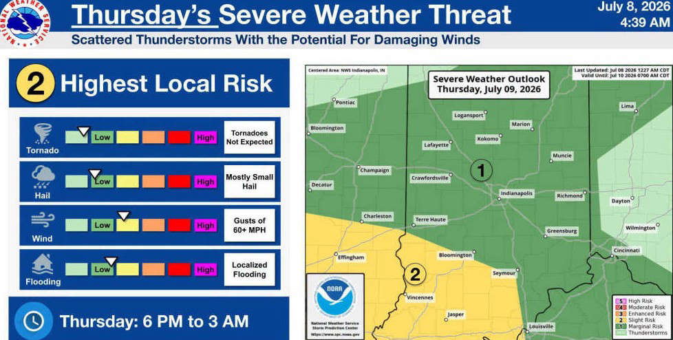
INDIANAPOLIS - The National Weather Service in Indianapolis is forecasting the potential for strong to severe thunderstorms across south-central Indiana on Thursday evening, July 9, into early Friday morning, July 10.
Bartholomew, Johnson, Jackson, Jennings, Decatur, Brown, and Shelby Counties are currently under a Marginal Risk (Level 1 of 5) for severe weather late Thursday into early Friday (6 p.m. to 3 a.m.).
Scattered thunderstorms are expected to develop during the evening and overnight hours. While widespread severe weather is not anticipated, the NWS says a few storms could become severe.
Thursday hazards include:
- Damaging wind gusts over 60 mph (primary threat)
- Small hail
- Localized flooding from heavy rainfall
- Tornadoes are not expected at this time
 Semi hits I-65 bridge over U.S. 31
 Greenwood Fire Department achieves 'ISO Class 1' rating
 Columbus Board of Works approves wellness contract extension for police officers
 BCSO arrests suspect following reported battery and firearm incident
 Ivy Tech Columbus celebrates 2026 Distinguished Alumni, Benefactor of Year honorees